
I
dedicate this work to the Jawans of Border Roads Organisation, whose
contribution to the country’s defence is often shadowed by their counterparts
serving the Infantry and Artillery.
I
also dedicate this to the thousands of contracted labour who actually toil endlessly
in these hostile regions to enable Ladakh stay connected with the rest of
India.
* *
* * *
Prologue-
I am one of those privileged few
who had a chance to see this God’s spectacular creation named by its
inhabitants as LADAKH in June 2010 after completing my final year engineering exams. Such is the exquisiteness of the place
that I had resolved to write this travelogue whilst voyaging on the Manali-Leh
road itself!!!
Sadly, as always, things did not go
as per plan. My joining date at the new job in Larsen & Toubro Limited, came too soon after returning home
in July and this resolution went on the back burner. Meanwhile, very suddenly and
equally sadly the recent floods converted Leh-Ladakh into prime-time news topic
which triggered back the Ladakh memories forcing me to honor my resolution. A
little word of encouragement from Sanjay Sainani, a college friend at VESIT [Vivekanand Education Society's Institute of Technology, Mumbai] set
me going finally.
Really speaking, I had actually
planned to write a travelogue on Ladakh-the place. While writing that, I
realized the Manali-Leh road has to get its share of space in it. So, as it
happens with Mumbai University engineers, we start with something, go in a different
direction and end up with a product totally different. A humble note to all,
even though this work is a result of improper planning, it has taken great
efforts to make it what it is. I have spent 10 days writing and I expect
atleast a reading time of ten odd minutes from you, before you comment on this.
To make your reading more
enjoyable, I have divided this work in 4 chapters, so that you can read it in
sessions at your leisure. If you are too occupied to even read a complete
chapter, I have introduced some break-points within the chapters too, so you do
not miss the link whenever you want to switch-on your new session.
Break point indication- * * * * *
A
word of caution, to all who think this work as some insipid and monotonous
stuff or who consider this road as any other Mountain Road [Ghats] without actually being there,
PLEASE DO NOT BE UNDER FALSE IMPRESSIONS.
1. Foreword
Mountains, without any flora, exposing their
bare brownish texture. That is the spontaneous image created in every tourist’s
mind at the sound of word ‘Ladakh’. This one sentence in itself captures the
complete charisma of Ladakh. But those are not any ordinary brown mountains.
God himself has rightly housed Ladakh within the heaven on earth, Kashmir
situated in the extreme north of India. Rather it is Ladakh which has been
prominently responsible for Kashmir being proclaimed as the heaven on earth.
The sky penetrating mountain peaks, encompass Ladakh valley from all sides. One
can sense, they are the ones actually accountable for the very special feel
this region has.
One has to see it, to believe it. Besides, one has to be
extremely lucky and needs to have some good money in his pockets to even see
it. The splendidly magnificent, serene and divine nature of the place itself decides whose foot-step has to be
permitted on its territory and whose has to be barred. So if you have been
there, consider yourself extremely lucky to have reached there and do trust me
when I say people have lost their lives in their quest to reach Ladakh.
If you do trust your luck and are already geared up for a
trek with your friends or a holiday with your family over there, the most
beautiful, memorable and adventurous way to reach would be, plying the 460 km
long Manali-Leh road. If you do ply on this road, there will be nothing better
than boasting that journey before your friends and relatives for many years
together. No other road in this world gives you such a feeling of adventurous
triumph. I can bet my life on the fact that every kilo-meter you travel will be
many times more than the worth of diesel you burn. Every moment you spend, over
the engineering marvel carved out by the BRO soldiers affiliated to Project
Deepak and Project Himank, will engrave a permanent slot in your memory for
years to come. Picturesque as it is, the road never ceases to keep you on your
toes. A full depiction of the Manali-Leh road as a travelogue is worth the
effort it took as well the number of lines and the amount of space it occupies.

On
the way to Leh near Sissu, some 70 km from Manali
* *
* * *
2. Day One
The most enjoyable way to take pleasure in your journey
would be by breaking the journey in atleast 2 days if not 3. My personal
suggestion would be to go for 3 break points. So the further portrayal in this
travelogue would be in sync with that.
The day before you start, please do sleep early and sleep
well. The roads
are not made to be slept on, they are made to be seen!!! Local transport agents and tourists at Manali have a
tendency to jam up every single day at Rohtang pass, which is the first pass
en-route to Leh.

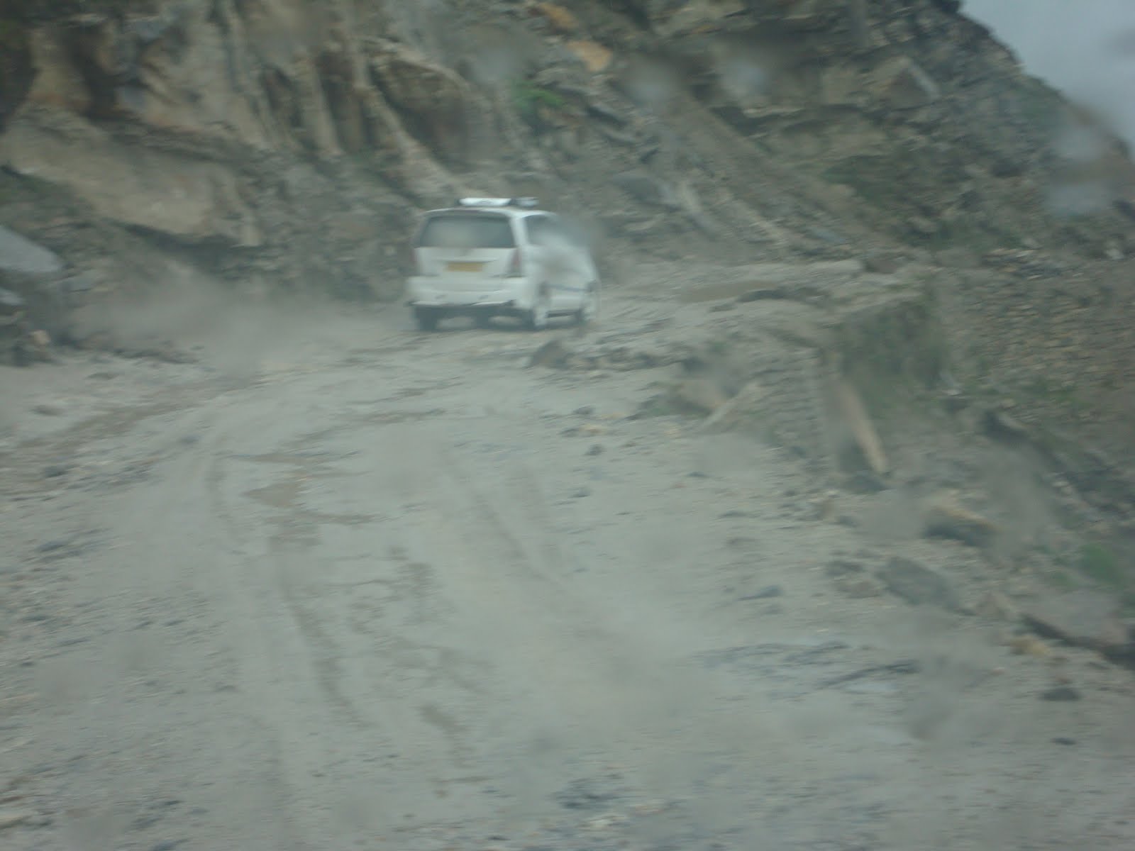
Heavy local traffic of Rohtang Tourists
Avoid the mad rush by starting very early, around 6. The
locals only travel 51 km to reach Rohtang but you have a 117 km travel to be
done to reach Keylong, your first break point. And yes, forget no matter what, but
do not forget to fill up your fuel tank and carry some 30 liters of spare fuel.
Who knows how your Internal Combustion engine would behave at those altitudes.
As you start from Manali [6398 ft], you continuously
climb a steep gradient to reach Rohtang Pass [13051 ft]. When you drive, you
see the never ending shops renting out warm clothes for Rohtang visitors. The
road travels in endless loops to climb up one mountain from the other, but
amazingly the entire road revolves around only about 5 mountains in its pursuit
of Rohtang.

The entire road in loops across these mountains visible just a notch below the Rohtang-Top
‘Malana’ is the last town on the road to house some cloth rental
shops before reaching Rohtang and Kothi is the last town offering a decent inn.
The stretch of about 20 km from Malana to Rohtang Pass will be the most
tiresome stretch of the day. Reason being, the gradient is very steep and it
rains almost every alternate day in heavy volumes to wash-off whatever little
road was built on dry days.
At
the mercy of mountain mud, from ‘Malana’ to Rohtang.
Marhi is the last place before Sissu, yet another tinsel
town of Himachal Pradesh, to host a ‘Dabha’. The Dabha at Marhi is the best
place to have your breakfast too. Else, the cold winds of Rohtang clubbed with
your empty stomach may nauseate you. Some 5 km before Rohtang you would be
already seeing the small snow gatherings at a few mountains in the vicinity and
some on your own road too. To avoid being excited too much by the snow, it is
advisable to have a separate trip to Rohtang, ideally 2 days prior to your Leh
trip. Firstly it helps you get acclimatized in those high altitude areas and
secondly you have a lot of time at your disposal for enjoying both, the snow at
Rohtang as well as your Leh road.

The
Dhaba at Marhi

One
of the last views of River Beas before the final ascend to Rohtang from Manali
At one point after Rohtang, your road is at such a great
height of the mountain that it becomes impossible to view the deep valley
sitting in your car. But if you have the nerves, you can enjoy the sight by
stepping out and peeking right down from the very edge of your road. The
picture below will mesmerize you more.

This
single mountain captured in the above frame, is exactly opposite to the
mountain housing Keylong city. The line like thing highlighted in red is
actually the road which brings you to the place from which this photo was
taken. And the height of a normal person is well below the half-thickness of
red line!!! The entire mountain could still not be captured in one picture,
taken almost 500 meters away from it. Also notice the shrinking density of tall
trees unlike the typical Himachal Pradesh. At the extreme right of the frame,
just above half the height, you can see a ‘3 floored’ monastery.
If you are a good observer, you can easily notice why
Rohtang is a great physical and psychological divider. As you cross over the
pass it takes some time for you to come across some inhabitants of the region
as you are already at a height of over 13,000 ft with the place covered all
over by snow and not conducive for sustaining human and animal life. After
crossing Rohtang en-route to Keylong, you discover that you are descending all
the more rapidly. You lose about 2000 feet within a flash of just 20 km!!! Now
you finally come across some small villages like Khoksar and Sissu. If you stop
over at these for the traditional Indian mid-way halt of ‘chai-biscuit’ you can
notice the changed features of the natives. They appear quite different from
the Punjabi speaking locals of the rest of Himachal. It will be now that the
Indo-Tibetan nature of the place finally starts to sink in. Welcome to the world of courteous, tourist
friendly people of the Keylong valley. It gives you a break from the
commercially exploiting Kullu-Manali valley. This is the psychological
difference between the northern and southern sides of Rohtang.
It’s not only the human physical appearance which
undergoes a drastic change. The local birds too expose some easily noticeable
physical diversity. The local crow in Keylong valley has a yellow beak and is
fully black unlike the one in Manali, which is quite similar to a city crow.

The
local crow at Keylong with a yellow beak.
* *
* * *
If you desire to keep in touch with your near & dear
ones from this point onwards, use a national roaming activated ‘postpaid’ service
of MTNL/BSNL. No other private operator even bothers to install their
transceivers at these remote villages on the way, spaced almost 25 km from each
other with a population of hardly 200 locals, housed at such difficult terrains
of India. BSNL towers will support you almost fully barring a few ‘dark-spots’
ranging from 100 meters to 3 kilometers.
Shortly after descending the mountain housing Rohtang,
you come across a two-way junction, one way of which goes to some interior
towns like Spiti, Kaza, Losar and many more all the way to the Indo-China
border, earlier known as the Indo-Tibetan border, and the other to Leh via
Keylong. As you take pleasure along the journey, you will awe the giant sized
fold mountain structures of Himalaya. If you are lucky enough and the sky is
clear you will be able to see the whole larger than anything imaginable
structures. I say this because the mountains are so huge that clouds are
present in 3 layers along the entire height of those. Seeing the entire
structures in one frame is a spectacle in itself.
Some 10 km before Keylong you reach Tandi [a.k.a
Tandipur], where you find the last petrol-pump before reaching Leh. Do observe
the sky-high prices, petrol pump owner commands and also the mad-rush of biking
enthusiasts filling up their not-so-economical-mountain-bikes, which is usually
a Royal-Enfield. After driving some 2 km from Tandi you will be on the mountain
shown above, from where you can easily see the Keylong town. It’ll be now that
AIRTEL SIM cards start receiving signals from the lone Base Transceiver Station
[BTS] of Keylong valley.
Keylong is also the last place, on the Manali-Leh route,
upto which the Himachal Pradesh state govt. [HPTDC] runs its buses. [Once in a
blue moon, HPTDC starts its Manali-Leh service too]

Excellent
engineering & planning enables BTS of BSNL & AIRTEL networks cover a 15
km stretch of Manali-Leh road on hilly terrain
The beautiful journey of Day-1 finally starts coming to
an end. HPTDC has built up a beautiful gigantic hotel in the upper half of the
town named ‘The Chandrabhaga’, located just near the local bus-stand, rooms for
which can be booked from Manali itself. But it’ll take some fortune to get a
good room with an excellent valley view. It will be better, in two perspectives,
to stay put in one of the many small hotels available at the bottom half of
Keylong town [Keylong town is spread over a single mountain. So it can be
divided into the upper & lower half]. Firstly you get to explore the ‘real’
features of the people, as the lower half is a home to most locals, and
secondly though these hotels are small they offer you much better view-rooms
and go easy on your pockets too. With the first day, comes the end of most
comfortable part of your journey.
As a part of next day’s preparation, eat healthy but eat
light .Most importantly do sleep well because- The roads are not made to be slept on, they are
made to be seen!!!
* *
* * *
3. Day
Two
The second day will be the most comfortable only in terms
of the starting time. You can easily start at around 9 am and reach Sarchu, a
place in Jammu & Kashmir some 115 km from Keylong located at a height of
14,500 feet above the sea level, your break-point for the second day
comfortably before dusk.
The second and third day’s travel continuously ascends
you to heights even greater than that of Leh itself. As soon as you cross over
the Keylong valley, after driving some 15 more kilo-meters you come across the
last town in Himachal Pradesh on the Manali-Leh route, named Darcha. After
crossing the Darcha region, a geographical transition from Himachal Pradesh to
Jammu & Kashmir region becomes apparent. You will easily notice some
distant barren brownish mountains at many curves on the road now, welcoming you
to the Ladakh valley even though you are still some 275-300 km away from Leh
city!!!

Distant
mountains with Ladakh-like features seen from road near Darcha exhibiting the
transition from Himachal Pradesh to Jammu & Kashmir.
As you keep driving and climbing, you notice the road
slowly starting to get covered by snow. Small patches of snow become visible
across the mountains in vicinity. The mountains on your road too by now become
almost devoid of vegetation. All these geographical indicators mark the
approaching Barlacha Pass a.k.a Barlacha La [The word ‘La’ in Tibetan language
means a mountain pass]. Barlacha La is a mountain pass situated at an even
higher altitude than that of Rohtang. Its height above the sea level is 16050
feet!!!

Large
patches of snow starting to appear on the way, indicating the approach of Barlacha
La.
It is from this point of road onwards, that people start
experiencing the Acute Mountain Sickness [AMS], a feeling common amongst
tourists travelling to places situated at heights more than 12,000 feet above
the sea-level. Not only you but your vehicle too starts showing some altitude
problem symptoms, most easily observable being the half-combusted black smoke
coming out of your vehicle exhausts.
* *
* * *
The route from this point until some 10-15 km beyond the Barlacha
point will be most exhilarating one of your entire journey. The scenes you saw
a day before, near Rohtang will now feel like child’s play compared to these
extravagant ones. Slowly the entire mountain starts being covered in snow which
encroaches on your road too. The snow covered mountains appear as if they have
been ‘Mummified’ with white cloth to preserve their magnificence!!!

A
complete mountain blanketed by snow on the most vulnerable and avalanche prone
zone of the Manali-Leh route.

The
snow wall formed on both sides of the road leaving a bare minimum space for a
single vehicle to pass through.

More
and more amazing sights await you, like the big frozen lake just a km before
the Barlacha La point.

The
Barlacha La point

The
Barlacha region will sometimes even force you to get down from your vehicles
and start removing the ice on the road for your vehicle to pass through.
There’s a real feeling of achievement when you literally carve out your road
and drive your vehicle rather than the insipid feeling of vehicle driving you
on the expressways.
The sights on descend from Barlacha La will be the last
sights of heavy snow over your roads till Leh. You will now cross the Himachal
Pradesh border to enter the Nyoma region, which is the first valley of J&K
and also the first division of Ladakh district. You will now officially be in
Ladakh valley but Leh is still some 200-250 km away. A 60 km drive from Barlacha
La will bring you to Sarchu, marking the end of second day’s journey. There are
no hotels to stay in Sarchu, only some Swiss tent camps with basic furniture
and bathroom facilities available. It’s basically a transit place for tourists
and an army check-post. Even the people who put up their tents live there only
for the four months of tourist season, while permanently staying in Leh. From
this point onwards, till Leh you will get only Maggi as a solid food and the
traditional Indian ‘Chai-Biscuit’ to compliment your travel. There’s no need of
an advice for light food when Maggi is all you can get!!! But yes do sleep well
to enjoy the longest journey of all days, which is approx 200 km, the next day,
because- The
roads are not made to be slept on, they are made to be seen!!!
Sarchu also marks the end of Project Dipak of B.R.O which
is responsible for maintaining the Manali-Sarchu section as well as it marks
the beginning of Project Himank of B.R.O which is responsible for the
Sarchu-Leh section.
Your third day will be the longest of all in terms of the
number of kilo-meters you have to go [approx 200]. As you move out a 2 km or so
from the vicinity of your tents, you will be witness to the most outlandish of
mountain patterns, shapes, forms or whatever you may call them. Suddenly out of
nowhere you see a plateau running more than 2 km at the base of those, now
completely ‘Ladaki’ mountains. And
then the river has excavated out a perfect rectangular slot for its flow, as if
it’s a canal carved out by skilled engineers. The severely V-shaped valley has
suddenly turned into this shape -


The
perfect slot excavated by the river in the first picture with the vast plateau
over it visible in the second picture below it, and a complete picture in the third one displayed above.
As you move forwards towards Pang- yet another camping
place, an army check-post and your breakfast halt for the third day, you notice
the mountains exposing their even weirder shapes. At a few places, if you
observe well, you easily decipher some meaningful objects from their
silhouette, including a human face as well. At this point, after seeing such
hugely gigantic mountains and the shapes they portray as if communicating
something, one may wonder if the old fable which states, mountains were earlier
some giants who could walk and hence were called ‘Chala’, meaning one who can
walk, in Sanskrit, are true enough. For those who find this tale interesting,
these ‘Chalas’ boasted of their power and caused destruction of lives. Finally
the Gods were fed-up and cursed these giants to be immobile for life. That’s
when the mountains came to be called ‘Achalas’, meaning one who cannot walk.
So, at this point, if you are a psycho like me, it may strike you that some of
these can still move or at-least change their shapes to secretly communicate,
otherwise how can you justify such weirdest of nature’s splendor.

The
human-face like shapes portrayed by mountains out of nowhere
Just as a food for thought, for those who are enchanted
by the ‘Chala’ and ‘Achala’ story, even J. K. Rowling narrates this fable of
‘Mountains can walk’, in her own breathtaking way, in the famous Harry Potter
series by showing Hagrid’s family of Giants.
* *
* * *
As the journey becomes more photogenic, it now starts
becoming tiring too. Prime reason being, the tar cover over your road by now is
fully washed off, so you are on the mercy of raw sand and stones. You may even
feel as if you are driving on some road in Afghanistan, as depicted in the film
‘Kabul Express’. The secondary factor which adds up to your tiring quotient is,
now the mountains are not closely bound as such. So if you want to migrate from
one giant to other, you have to climb down the entire slope and, drive in the
short valley, and again climb up the subsequent one. The Indian govt. simply
cannot afford to build huge viaducts to span these terrains, used by not even 100
vehicles daily. A picture will explain better.

Notice
the tiny army overpass, taming the river, which has to be crossed after
climbing down the entire mountain.
This stretch of Morey plateau ends at a small camping
place, called Gya. It is from this point onwards that you start seeing some
J&K state govt. run buses ferrying people to Leh.

This
picture of mine was taken near the end of Morey plateau. The Mountain you see
in the back-drop is a kilo-meter away.
* *
* * *
Immediately after the Morey plateau adventure, your final
climb of the road till Leh starts. You are now on the way to surmount Taglang
La [Height 17582 ft], the second highest motorable road in the world and also
your final pass before you reach Leh!!! The road will again bring some nausea
with it, but don’t let the mountain sickness overcome your excitement and
anxiety of reaching your destination. Road on this particular climb will be
stony, dusty as well as narrow with a steep valley on one side. Temperatures
will again start to fall as it brings back the memories of Rohtang and Barlacha
La. Even after being the second highest motorable road you see very less snow
in your vicinity as compared to the scenes you witnessed in Barlacha La, reason
being this mountain region lays in the rain shadow region of Himalayas. The Barlacha
La ranges have already consumed most of the South West monsoon winds. After
some vigilant and skilled driving by the driver and perseverance on the
passenger’s part you finally are on second top of the world!!!

At
the Taglang La top.
It’s only a matter of time now before you reach Leh,
though still some 111 km away. You will see this distance being covered within
3 hours from this point onwards. The climb down from Taglang La will be the
only bad phase of your path now. Shortly after descending the mountain within a
run of 15 km, you reach the area already at the height of Leh [13000 ft]. From
now on, it’s just a plain road to be plied on with one of the Indus’s tributary
giving you beautiful companionship. By now your driver will go all out to remove
his hill-road-frustration by driving at velocities not less than 75 KMPH. You
too will now anything but enjoy that speed. The 60 km plain road till Upshi,
though plain in itself, will be covered severely by the mountains with no view
whatsoever, a strange choking feeling after the vast line of sight range you
experienced at Taglang La top.
Shortly you will be at Upshi, your last ‘Chai-biscuit’
halt of the expedition and the last army check-point of the Manali-Leh road.
Here you finally get a ‘Darshan’ of the original Indus a.k.a Sindhu River over
there, because of it being the most revered river by Sindhis [The Indus
terminated into Arabian Sea in Sindh province of Undivided-Prepartitioned India and Leh is now the only place where you can have a good-safe dip in the river]. Here the
J&K govt. recovers a green tax from you against the privilege of the drive
you will soon take pleasurably in Leh. The beeps from your private network
powered mobiles will soon raise your spirits!

First
‘Darshan’ of the ‘Holy Sindhu’ near Upshi.
Very soon you will reach Karu, the outskirts and the army
cantonment of Leh. For security reasons I do not wish to disclose the details
of the vastly spread cantonment, stretched across about 10 sq km of the land at
Karu. Nevertheless, when you travel there, feel proud of your country’s
defence. At this point it may already be 4 in the evening, and still some 45 km
to go before you reach Leh city. As matter of advice inform your hotel in
advance about the dinner you may like, if you stay at a small one like mine
[The market there closes early in the evening].
The next 45 km, from Karu to Leh will be by far the best.
Firstly, now you are on the National Highway-1, the most prestigious of our
country connecting Delhi to Leh via Jammu and Srinagar. Secondly you see some
trees after a very long time. Thirdly, the thrill of reaching your destination
and lastly you enjoy a panoramic view, the view-choking mountains being very
far away from your road now. Within all this excitement do notice the small
white-coated temple like builds on either side of the road, built by Ladakh
natives. The local Tibetan migrants pray in these individually built temples.
Also notice the small channels excavated from Indus, to bring in water for the
man-made cultivations on either side of roads, an attempt to turn Leh more
beautiful and comfortable to live in.
As you notice these beautiful pictures sink inside you,
go, fall in love with the most diversely beautiful voyage you have just
finished, which has demonstrated all of the nature’s marvels from dense green
Deodars to blankets of snow to the ocher colored trademark mountains of Ladakh valley, finally
immersing your thoughts in the deep-blue waters of Indus.

Mesmerizing aqua of the deep blue Indus
is at its striking best, in addition to the ‘Dessert’ with an ‘Icy topping’.
* *
* * *

Note- This picture has directly borrowed from the internet for representational purpose. The division of the break-points of the 3 days are the owner's portrayal.
* *
* * *
Acknowledgements-
This work is not a result of my efforts alone and would
hence be incomplete without thanking the people who helped make this what it
is.
Firstly, I would thank my parents, uncle and aunty for sponsoring
and planning this trip so well, by chalking out the minutest details well in advance
and executing it so meticulously. Their efforts in the background helped me
enjoy and observe the road to my full, which makes this work achieve the depth
it has.
I also thank my siblings Sidhesh, Neelesh and especially
Priya for tolerating my facetious remarks and ‘pakau’est of jokes, accompanied by those songs with the stupidest
of lyrics, in my hoarse voice while travelling. I actually wanted to bring in some
amusement in the journey but, it turned out that, I actually made their trip a
hell!!!
Last, but never the least, I
would be too rude if I do not thank our driver Manjeet Singh, who accomplished this 3 day task in just 2 days, by
driving almost for twelve hours with very little breaks on the second day, and still
managing to be cheerful at the end of it all.
* *
* * *
Epilogue-
The next 4-5 days I had at Ladakh were the days to remember
for life. It had everything from the shimmering sand at Mt. Lamayuru to the
remotest of Monasteries at mountain tops, the Leh palace with the King living
there till date, the double humped camels at white desert sand in Nubra valley,
a Bon-fire at a camp in Nubra valley with an overnight stay and the most
beautiful Pangong lake, which features in the last scene of 3 idiots.
Nevertheless, more than these places, the roads which take you there are a treat
to drive on, with Khardung La, [Ht- 18380 ft] the world’s highest motorable
road and Chang La, [Ht- 17585 ft] the world’s third highest motorable road, on
the way, completing the trio of 3 highest roads in the world.
Watch out for all this and more in my sequel- Ladakh- A Beautiful ‘Dessert’ with An ’Icy-Topping’
-Ashish S. Lalla [The Travelover]
Gosh !!!! just dont have any words to describe the way u presented this beautiful place before all of us .. with each day passing in the above write up I could actually feel that I was a part of group travelling along the hlls of this majnifiecient journey...well to add to this I have just finished reading the write up till day 2 ..but just could nt resist commenting on your work and the great detail of efort taken to make this write up .. so just scrolled down to find out where I could pen down my feelings and the experience that I had on reading your work ..
ReplyDeleteGood Work !! excellent writing and beautiful mix of photos and punchy phrases..Eagerly waiting to read some more blogs from ur side ..and at the same time satrt pushing Pawan (my husband) to take me to this 'heaven on earth'
Looks like a novel to me... :)
ReplyDeletetoo good... I have not read it as yet but saw all the pics that are there. You are too good narrator. keep it up, The Travelover...
@Jay-
ReplyDeletethnx a lot for taking out time & having a look at it